Our geographic region covers approximately 32,047 square kilometres.
Along the eastern boundary is the coast, and to the west the New England Tablelands escarpment and a line of state forests and national parks. The northern boundary is the Queensland border and the southern boundary extends beyond Port Macquarie.
Approximately 520,000 people live on the North Coast spread across the region in diverse locations. Major population centres are located on the coast and the major river systems that divide the region, with more rural and remote townships located inland.
The North Coast region is more disadvantaged when compared with NSW. Disadvantage indicators include high ageing, Aboriginal, disability, remote and unemployed populations.
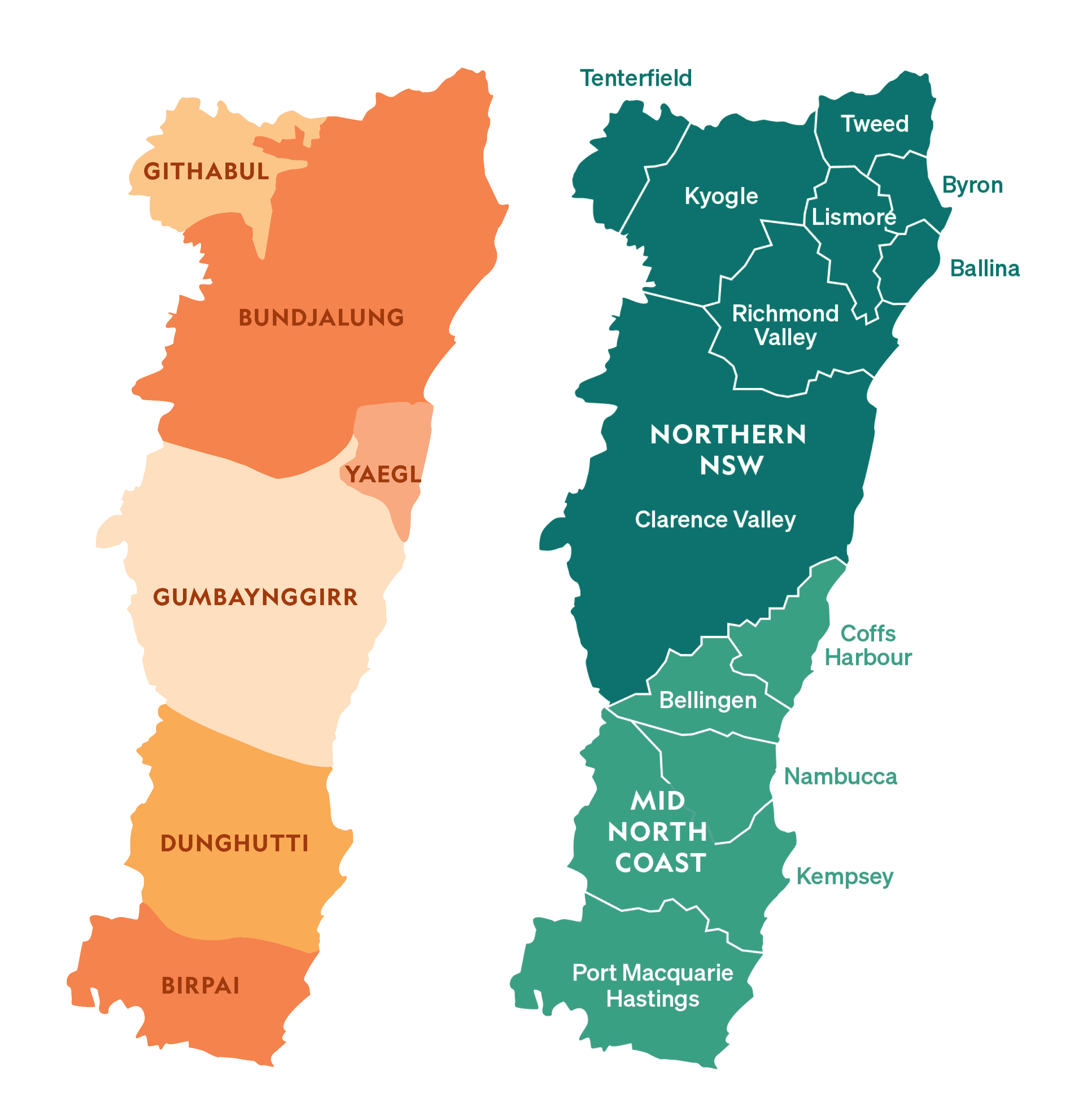
Healthy North Coast covers the combined geographical regions of Northern NSW Local Health District and Mid North Coast Local Health District. Maps of our footprint and the Aboriginal nations within the footprint are shown here.


